Neue Routen
Hinweis:
Diese Plattform wird am 21.05.2026 dauerhaft eingestellt.
Bitte exportieren Sie Ihre Routen rechtzeitig. Alle personenbezogenen Daten werden anschließend vollständig gelöscht.
Unter dem Reiter Meine Routen gibt es die Möglichkeit, Ihre Routen in GPX-Dateien in einer ZIP-Datei herunterzuladen.
→ Weitere Informationen im Blog.
Willkommen bei runnr!
runnr bietet Routen für Läufer, Wanderer, Radfahrer, Roller-Blader und Spaziergänger und verwendet dafür die Karten von Google Maps und OpenStreetMap.
Mit runnr können Sie Ihre eigenen Routen in einer Karte einzeichnen oder aus einer GPX-Datei importieren, für sich speichern oder sie anderen zur Verfügung stellen.
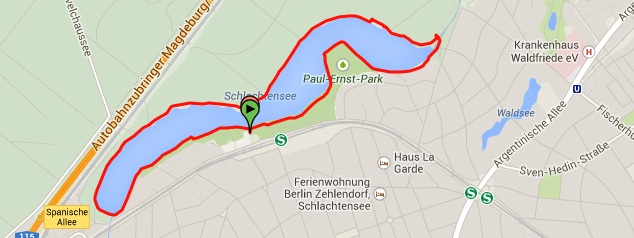
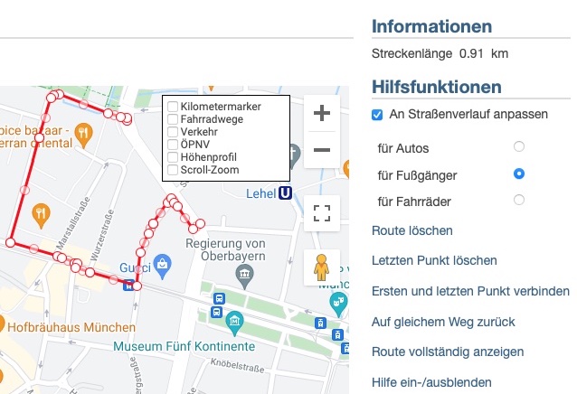
Sie wollen wissen, wie lang Ihre Laufstrecke ist? Zeichnen Sie sie in die Karte ein und lesen Sie sofort die Länge der Strecke ab.
Dabei kann die Route automatisch an den Straßenverlauf angepasst werden, um das Einzeichnen zu erleichtern.
Durch die Verwendung von Google Maps können Sie auch Satellitenbilder verwenden, was das Finden von z.B. Feldwegen vereinfacht, die auf Straßenkarten nicht sichtbar sind.
Auch die Karten von OpenStreetMap bieten sehr oft einen hohen Detaillierungsgrad.
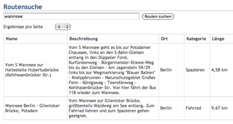
Sie suchen eine Idee für den nächsten Ausflug oder Spaziergang?
Über die Routensuche können Sie schnell in den öffentlichen Routen suchen.
Teilen Sie Routen über Links auf öffentliche Routen oder exportieren Sie sie als GPX-Datei für externe Geräte.
Die Nutzung von runnr ist kostenlos.